
A tropical storm watch and another for severe thunderstorms are in effect for the area.
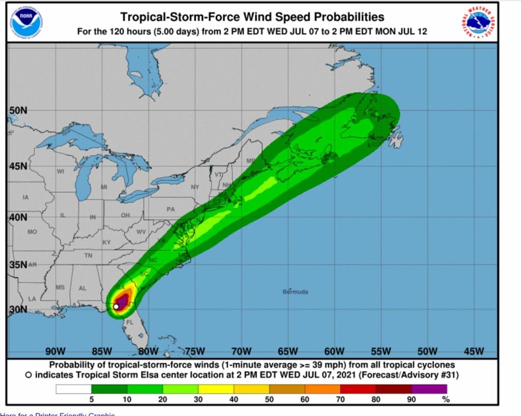
The National Weather Service said Wednesday that Tropical Storm Elsa will move up the East Coast Thursday while weakening to a tropical depression.
But the storm will then reintensify to tropical storm strength as it passes
near or over the Mid Atlantic coast late Thursday night, and near or over Long Island and southeast New England on Friday.
A Tropical Storm Watch means tropical storm-force winds are possible
somewhere within this area within the next 48 hours
The main threats from Elsa are heavy rain capable of producing flash
flooding, tropical storm force winds especially along the south shore
of Long Island and across southeast Connecticut, and associated marine
and coastal hazards, including very rough seas and dangerous rip
currents.
Rainfall of 2 to 3 inches with locally higher amounts is forecast from
Thursday afternoon into Friday.
PSEG Long Island said it is prepared for the remnants of the first named hurricane of the season to reach the area.
“High winds can send debris flying, topple trees and bring down power lines,” said Michael Sullivan, senior director of Transmission & Distribution at PSEG Long Island. “Employees and contractors are prepared to respond to and restore any outages caused by the storm safely and as quickly as possible.”
PSEG Long Island has additional personnel ready to respond throughout the storm.
Heat index values are estimated at 102 egrees, with the alert in effect until 8 p.m.
There’s also a 50 percent chance of showers and thunderstorms, mainly before 2am. Some of the storms could produce gusty winds and heavy rain.
Air quality forecasts are available on the Department of Environmental Conservation website at :
http://www.dec.ny.gov/cfmx/extapps/aqi/aqi_forecast.cfm
Information about ozone and health is available on the New York State Department of Health Website at:
http://www.health.ny.gov/environmental/outdoors/air/ozone.htm