
The Suffolk County Legislature approved new boundaries for districts this week after a drawn-out process that lasted for months.
Huntington will be represented by five legislators; three Republicans and two Democrats. The new districts take effect in January 2024 with voters picking legislators in November 2023. And many Huntington voters will find new names on the ballot when they cast their ballots.
The district includes the Huntington Town portion of Commack and Fort Salonga, San Remo, Kings Park, Nissequogue, Head of the Harbor, Smithtown and St. James.
The 15th will expand into parte of Melville. Previously, the 15h included Wheatley Heights, Wyandanch, North Amityville, Amityville Village, Copiague, parts of North Lindenhurst, West Babylon and North Babylon, and the Suffolk county portion of Farmingdale.
The 16th previously included Commack, Dix Hills, East Northport, Elwood, Melville and South Huntington in Huntington, Deer Park in the Town of Babylon and Brentwood and North Bay Shore in the Town of Islip. The district will move further into Huntington Station.
The district will continue to include parts of Huntington, but will move further into Deer Park. It previously included all or parts of the communities of Cold Spring Hills, Deer Park, Dix Hills, Huntington, Huntington Station, South Huntington, Melville, North Babylon, West Babylon and West Hills.
The new 18th will cover northern and central Huntington, and runs from the Nassau border to Fort Salonga, dipping down along the Nassau border into the West HIlls area.
The new maps create four districts that are majority-minority, including three in Huntington: Districts 15, 16 and 17. The fourth is District 9, covering Brentwood, Bay Shore and Islip hamlet.
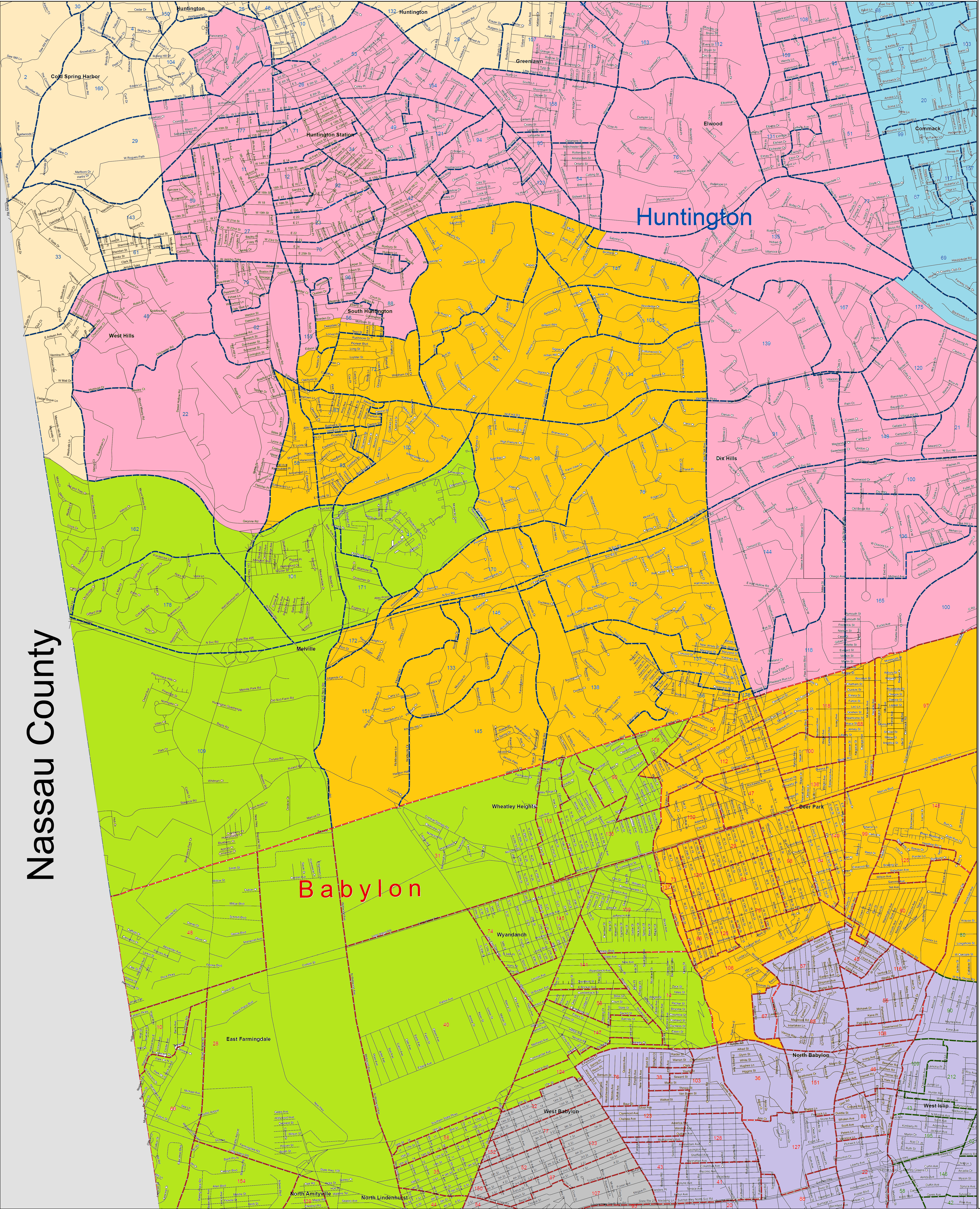
Northwest and Northeast Huntington maps
Southern portion of Huntington map
What is the significance of the heavy black borders that each encompass multiple districts? Do the heavy yellow borders outline districts? Please add a key to the published map and enlarge the district numbers – they are not readable unless one zooms way in. It makes no sense to me to split census-designated places? I am now in the contorted (gerrymandered) 16th district, which includes part of Dix Hills and part of South Huntington, but all of Huntington Station and Elwood.
Those are town lines. And if you clcik on the links to maps and enlarge significantly, you can figure out what district you’re in. These are not our maps; they are created by the legislature, so we can’t help you with the numbering problem.