
At least five inches of snow is expected as the first real snowstorm of the season will likely hit the Huntington area overnight.
Huntington Supervisor Ed Smyth delivered an alert about 5:30 p.m., that said the town was ready for the snow; the highway department said it has 130 snow plow operators but could use more. If anyone is interested, they can call 631 499-0444 or apply online at huntingtonny.gov/highway.
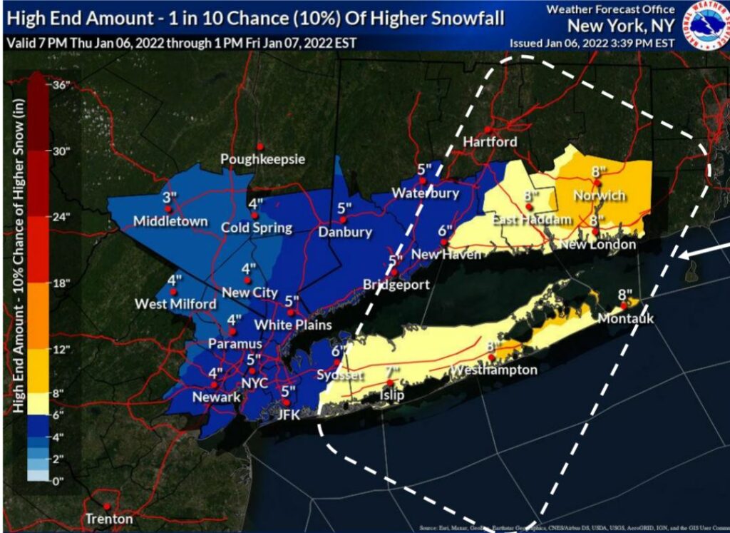
The National Weather Service said:
The snow will hit from midnight Thursday night to noon Friday.
Travel will be difficult. The hazardous conditions will likely affect the morning commute.
If you must travel, keep an extra flashlight, food, and water in your vehicle in case of an emergency.
Temperatures are expected to remain in the mid-20s.
“A quick moving but intensifying low pressure system is expected to bring a period of moderate to heavy snow for the Friday morning commute,” the weather service said in a Thursday evening advisory.
Several school districts announced declared Friday a snow day, including Huntington, Half Hollow Hills, South Huntington, Northport and Cold Spring Harbor.
Smyth said other town departments, such as general services, the Dix Hills Water District and Streelighting are helping with the snow response by lendingequipement and personnel to the highway department.
See HuntingtonNow’s Twitter list of weather experts to follow.
HART Bus: HART will assess conditions and make a determination on affected routes, if any, at 6 am Friday. Call HART: (631) 427-8287.
As of Thursday evening, trash collection is unchanged.
- Report power outages or downed wires to PSEG Long Island at 1-800-490-0075, psegliny.com or text OUT to PSEGLI or (773454).
- In the event of a gas emergency, or if you smell gas, National Grid advises you to call 911 or 1-800-490-0045.
Gov. Kathy Hochul urged New Yorkers to avoid unnecessary travel in several parts of the state as two weather systems are expected to produce snow and gusting winds in multiple regions, causing snow and ice-covered roads, low visibility, and potentially dangerous travel conditions through Friday morning. Western New York and the North Country are expected to receive more than a foot of lake effect snow through Friday, with wind gusts up to 40 mph, causing whiteout conditions at times.