
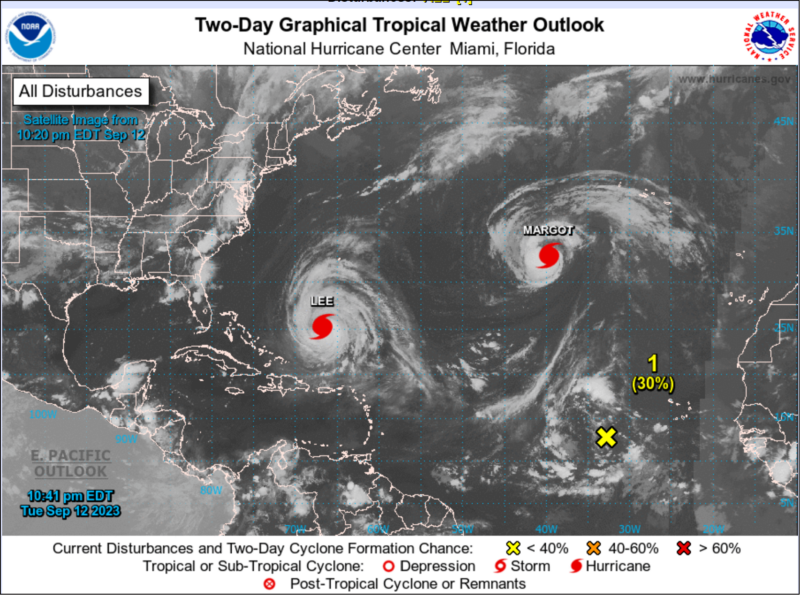
 Long Islanders are advised to keep an eye on weather reports this week, as Hurricane Lee churns up the Atlantic.
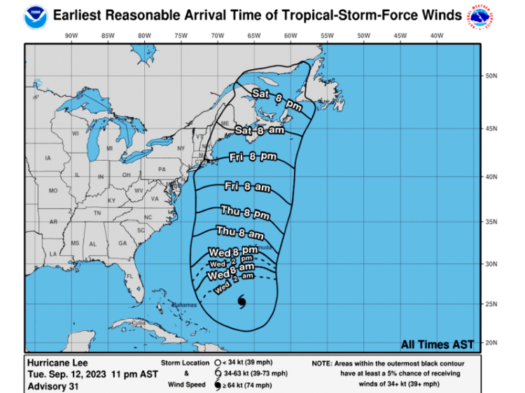
The National Weather Service said Tuesday night that it is too early to tell what impact the storm might have in the Northeast. Predictions are changing by the hour.
There is a marginal risk for severe thunderstorms Wednesday with the possibility for damaging winds as well as a small tornado.
Gov. Kathy Hochul announced Tuesday that 50 National Guard soldiers will begin preparations on Long Island as Hurricane Lee continues to move northwest and strengthen in the Atlantic Ocean. The deployment comes as state agencies prepare for a hurricane that could cause dangerous high surf, rip currents, coastal flooding, and beach erosion along parts of the east coast later this week as it moves north. While the final path of the storm is still unclear, Hochul is urging New Yorkers to closely monitor the storm’s development this week and ensure they are taking the appropriate steps to keep their households safe, if it ends up impacting New York State.
“A major hurricane is currently churning in the Atlantic and we are keeping a close eye on this storm because it’s too early to predict what this potentially dangerous weather system will do,” Hochul said. “Out of an abundance of caution, I have deployed the National Guard and directed state agencies to prepare emergency response assets and be ready to respond to local requests for assistance. New Yorkers in coastal areas should watch the forecast and be ready to act, if necessary, to stay safe.”
A flood watch is in effect from 8 a.m. Wednesday through 2 a.m. Thursday.