
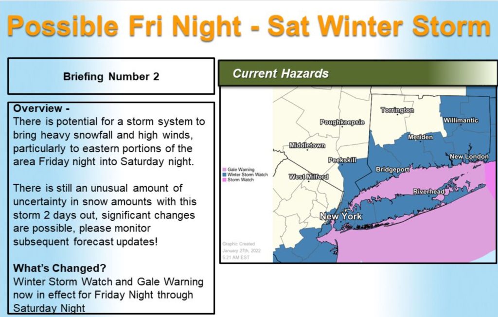
A winter storm watch is in effect for 24 hours beginning at 7 p.m. Friday, the National Weather Service said Thursday morning.
Heavy snow is possible, with snow accumulations of 6 to 12 inches, and wind gusts up to 45 MPH. However, the weather service made a point of saying that “there continues to be a greater than usual forecast uncertainty with the track of this storm, and the axis of heaviest snowfall may shift in subsequent forecast updatesThe town asks residents to avoid parking on the streets so that plows can operate and clear roads.
Flooding is also a concern for Saturday night, with heavy winds coupled with a 8-foot, 4-inch tide forecast at 9:15 p.m.
“We are expecting flooding on the Lloyd Harbor Road and Asharoken Avenue causeways, which would likely ice over with the low overnight temperatures forecasted,” the town said. “Our Highway Department is prepared in case the causeways becomeimpassable; they will leave payloaders and trucks on the Lloyd Neck and Eatons Neck sides of those causeways as a precaution on Friday.”
The Suffolk SPCA again reminded residents to keep their pets out of the cold and wet weather.
To report a loss of power to PSEG: Text OUT to PSEGLI at 773454 or visit: https://www.psegliny.
American Red Cross: How to Get Help: https://www.redcross.
To Report a Downed Power Line to PSEG call: 1-800-490-0075
American Red Cross: How to Get Help: https://www.redcross.
The track of the coastal storm takes it to the north & east of #LongIsland w/ the potential for heavy snow, strong winds & rough waves to impact the region. This is a difficult forecast as the forecast track has & will continue to shift a little more. #news12li @News12LI pic.twitter.com/FMSYIf59oU
— Addison Green (@AddisonGreenWX) January 27, 2022